 |
 |
Collins in Griffith's Valuation
Page last modified: Monday, 15-Jun-2020 01:38:12 EDT
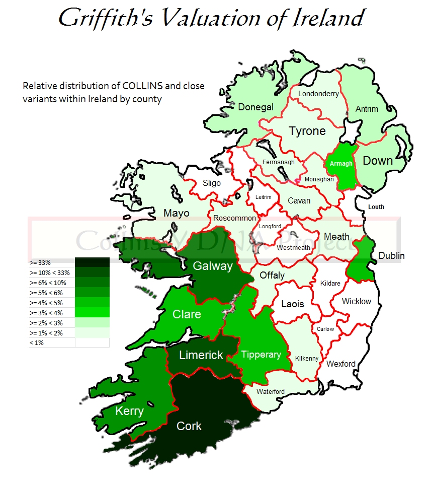
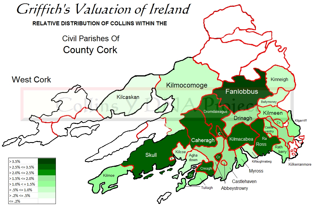
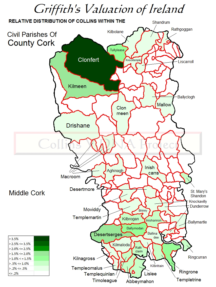
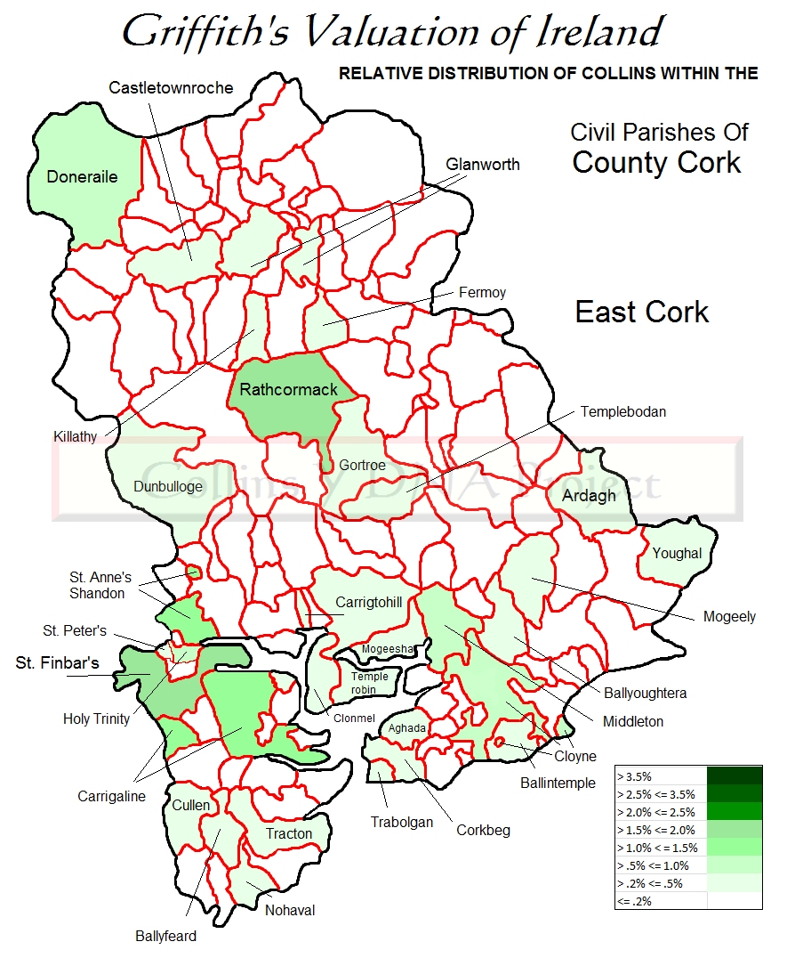
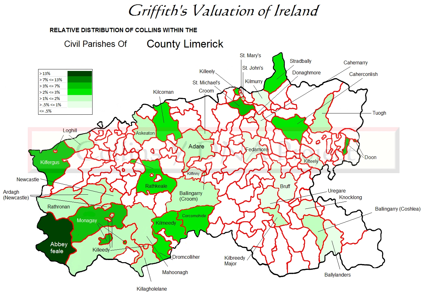
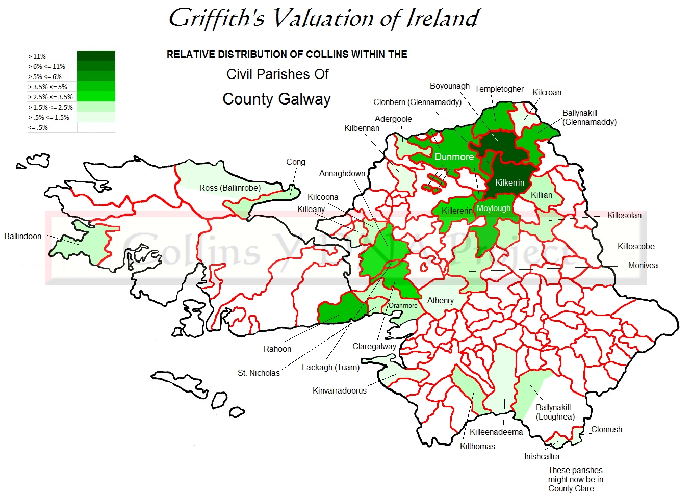
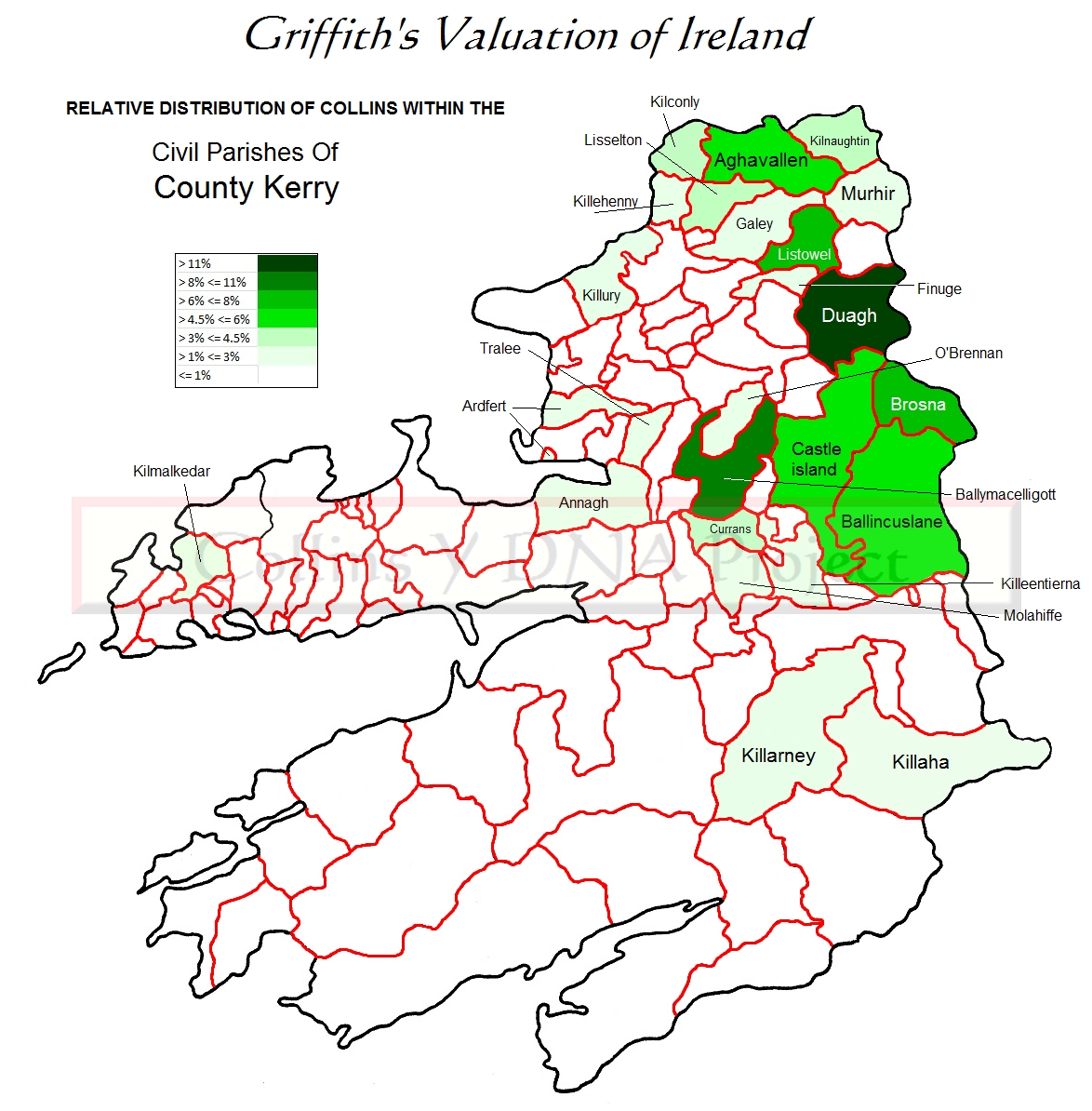
The first map shows the relative distribution of Collins by county in all of Ireland in the mid-19th century. The remaining maps are county maps showing the relative distribution of Collins within that county by civil parish.
The top four counties are mapped - Cork, Limerick, Galway, and Kerry. Together, the first three counties in that list hold nearly 50% of recorded Collinses in the valuation. The next tier of relative distribution includes the counties Clare, Tipperary, Dublin, and Armagh.
Cork is very large so it is shown on three maps - west, middle, and east. Limerick, Galway, and Kerry are each on one map.
See: A New Genealogical Atlas of Ireland by Brian Mitchell for original civil parish maps.
| Cork | Limerick | Galway | Kerry |
Back to top
County Cork
County Limerick
County Galway
County Kerry
| Collins at FTDNA | DNA Portal | Pedigrees | |
| See ABOUT for website information. | |||
| Copyright © 2015 - 2026 collins.dnagen.org. All rights reserved. | |||